It Appears Our Break From Winter Will Be Short(very)
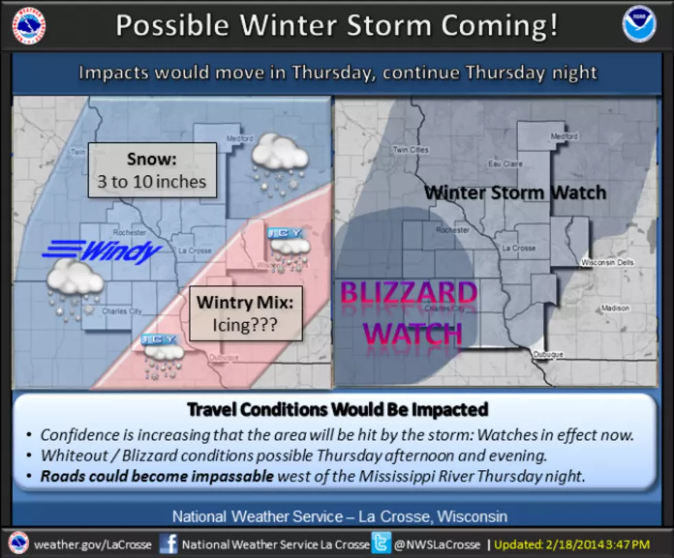
The National Weather Service is keeping tabs on a developing system that could bring a major winter storm to the Rochester area on Thursday. The exact track of the storm system remains uncertain, but forecasters say it appears likely southeastern Minnesota and portions of Wisconsin will take a direct hit. A blizzard watch has been posted for the region from 6 a.m. Thursday through 6 a.m. on Friday. At this point, it appears an icy mix of precipitation will precede a period of heavy snow, with snowfall totals above a half-foot possible. Forecasters expect the heavy snow to be followed by gusty winds that could make travel impossible in some areas Thursday night. The potential storm will follow a brief reprieve from winter. The unofficial high temperature in Rochester on Tuesday was 38-degrees, which is the warmest it’s been since December 2nd. A high near 40-degrees is forecast for Wednesday.
More From Y-105FM