Hot and Muggy Day Leads to Tornado Watch
La Crosse, WI (KROC-AM News) - The National Weather Service has issued a heat advisory for a large area of southern Minnesota and is predicting a stormy night for much of the state.
The heat advisory covers southwestern and south-central Minnesota, with the eastern edge of the advisory area following the I-35 corridor south from the Twin Cities. Areas to the west of I-35 are expecting to see heat index readings of 100 or above into the early evening with the temperatures climbing to around 90-degrees with high humidity.
The Rochester area and the southeast corner of the state are not included in the heat advisory, but a hot and sticky day is forecast for the region with heat index readings expected to reach nearly 100.
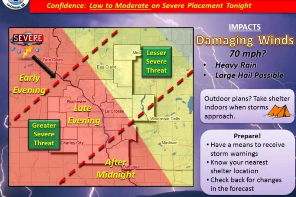
The heat and moisture in the air is expected to create a great deal of instability in the atmosphere by late in the afternoon in western Minnesota, while the main storm threat in eastern Minnesota will be this evening and tonight. The National Weather Service is indicating there is a moderate risk of severe weather from west central Minnesota through southeastern Minnesota and into west Wisconsin and northern Iowa.
At this point, forecasters are saying the highest potential for severe storms in the Rochester area will be in the late evening and into the late night hours. A tornado watch has been issued for a large area covering most of the southern two-thirds of Minnesota, including Rochester, through 1 a.m. Monday.
More From Y-105FM