Severe Thunderstorms Possible Tonight
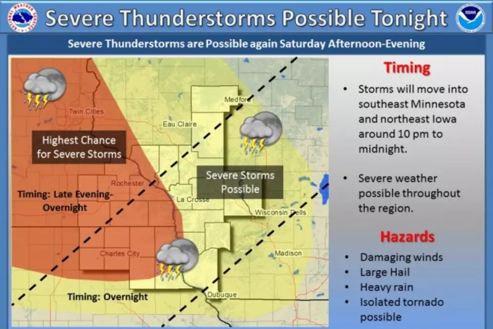
The National Weather Service is advising people living in southeastern Minnesota and northeast Iowa to keep track of weather conditions tonight because of the possibility of severe storms.
Forecasters say a cluster of thunderstorms could move into the region after cruising through the eastern Dakotas and west-central Minnesota. The main threat from the storms will be damaging winds, large hail, and heavy rain with a small risk for isolated tornado activity.
The National Weather Service is expecting the storms to arrive in southeastern Minnesota between 10 PM and midnight.
More From Y-105FM