
Winter Weather Advisory Tonight Means Slick Roads on the Way to Work Tomorrow Morning
This morning, National Weather Service in La Crosse posted a Winter Weather Advisory for us on their Facebook page. It'll start tonight at 7 and run thru noon tomorrow. What do you need to worry about?
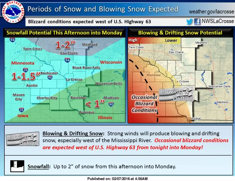
The biggest deal looks like the wind, which'll mean a bunch of blowing and drifting snow. Only an inch / inch and a half of accumulation is expected, so not a ton of snow, but add a slippery morning commute to the blowing snow and you'll definitely need to be ready to get out of the house 10-15 minutes early. More if you're pokey like me.
I know 10-15 minutes doesn't sound like much now, but you know by tomorrow morning, you'll be extra tired because of the Super Bowl, and it'll be so hard to not snooze, right? And I say all this with all the extra traffic deaths we've had recently. I don't want you to be another number, and being in just a little bit of a hurry can land you in the ditch or much much worse.
The official language says...
Strong northwest winds will develop across the area this evening and continue into Monday. The combination of these winds, a pre-existing snow pack, and up to 1.5 inches of new snow will produce considerable blowing and drifting snow west of the Mississippi River from tonight into Monday. Occasional blizzard conditions are expected west of U.S. Highway 63 and occasional white-outs elsewhere in northeast Iowa and southeast Minnesota. Travel is expected to become severely impacted!
More From Y-105FM


