MINNESOTA & IOWA: Damaging Winds, Hail, Tornadoes On The Way
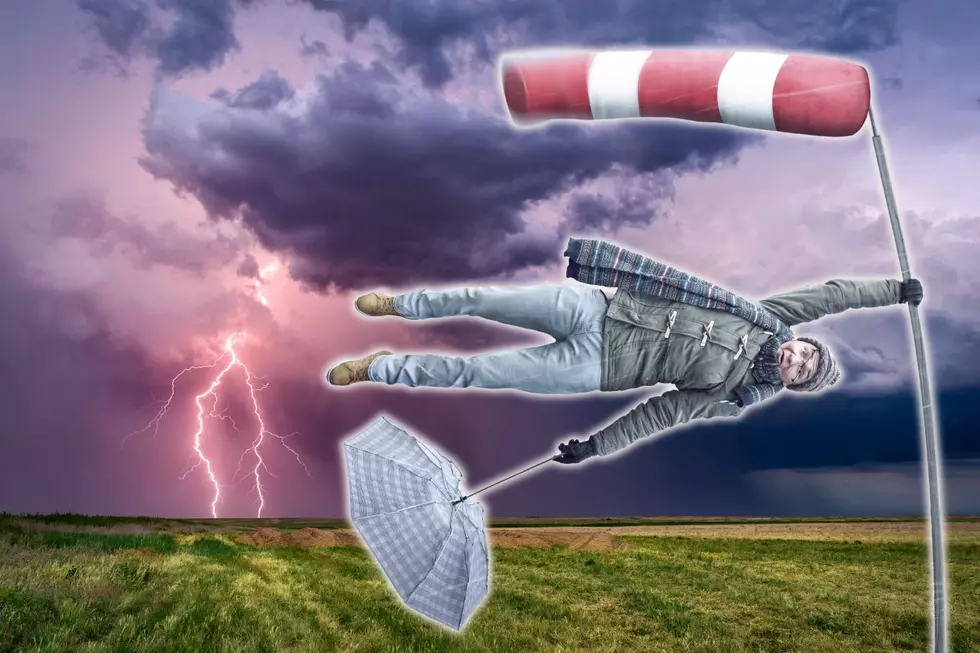
Before you leave for school or work on Tuesday, residents in Iowa, Minnesota, and Wisconsin are urged to make sure all items on their property are secure. If you don't, there is a chance those items won't be there when you come back home. And no, it is not because someone is stealing them. Mother Nature decided we had enough nice days and she is ready to show the midwest a bit of nasty weather.
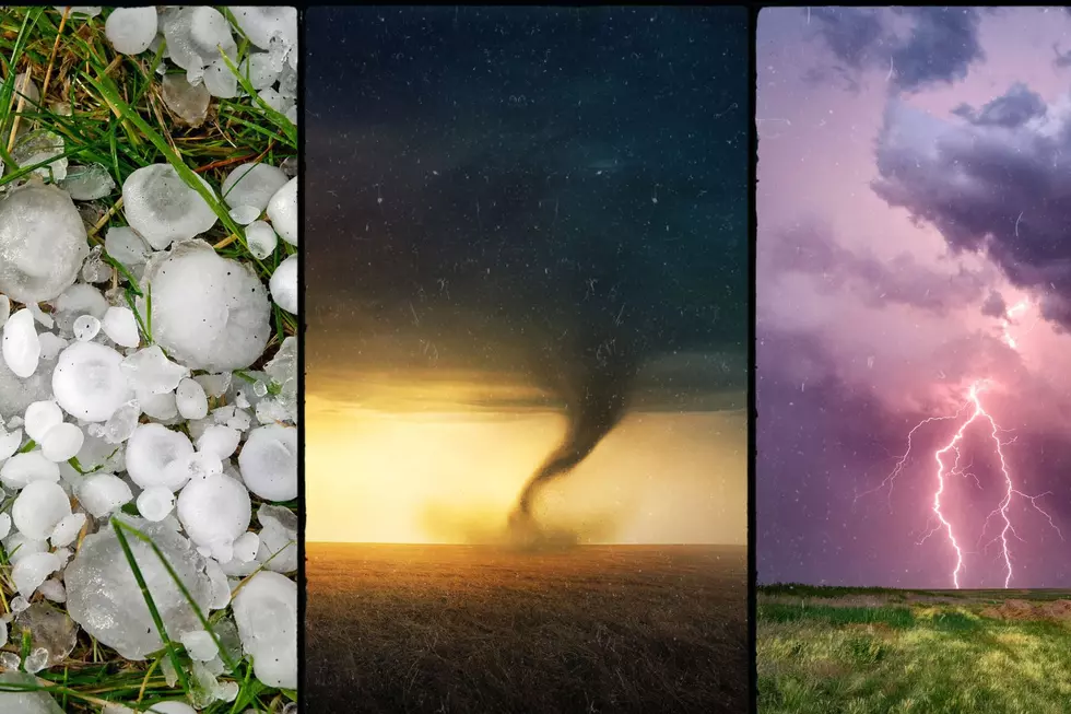
Brace For Impact! Damaging Winds, Hail, Thunderstorms, and Threat of Tornadoes in Midwest Possible
We were just saying at our house that a good 'ol thunderstorm would be perfect right now. Hopefully that little wish isn't what woke Mother Nature up. If so, I'm so sorry! An epic storm is headed towards Iowa, Minnesota, and Wisconsin and now is the time to brace yourself for impact. I should say, make sure all of the items outside that aren't secured are braced. Here is what each state is expected to get the next few days according to the National Weather Service:
WEATHER EXPECTATIONS AND ADVISORIES IN IOWA:
- HAZARDOUS WEATHER
- DAY ONE (MONDAY): Thunderstorms likely. A few storms may be severe with large hail.
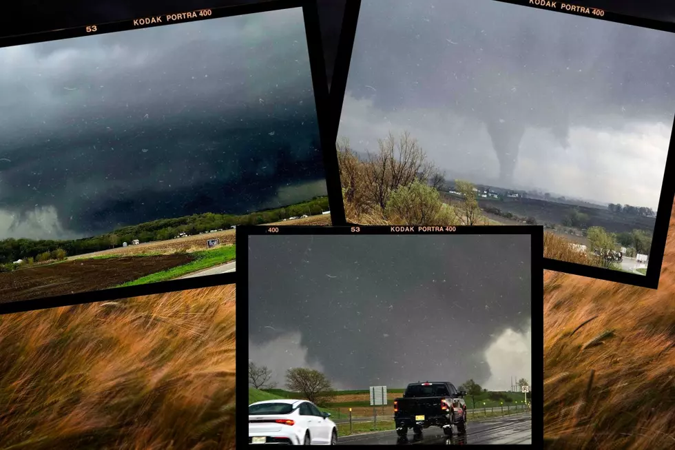
- DAY TWO THROUGH SEVEN (Tuesday through Sunday): Expect thunderstorms Tuesday and Tuesday night with marginal to slight risk of severe weather. Large hail, damaging winds, and a few tornadoes will all be possible along with locally heavy rains.
- LOCATION: most of Iowa is impacted. See updated locations here.
- WIND ADVISORY - issued April 15 at 9:36 PM CDT until April 16 at 7:00 PM CDT.
- WHAT: Expect East winds 20 to 30 mph with gusts up to 45 mph.
- WHERE: Portions of north central and northeast Iowa
- WHEN: 7:00 am to 7:00 pm CDT Tuesday
- IMPACTS: Gusty winds will blow around unsecured objects. Tree limbs could be blown down and a few power outages may result. Winds this strong can make driving difficult, especially for high profile vehicles.
- WIND ADVISORY - issued April 15 at 9:14 PM CDT until April 16 at 7:00 PM CDT.
- WHAT: Expect Southeast winds 25 to 35 mph with gusts up to 45 mph.
- WHERE: Portions of northern and northeast Iowa.
- WHEN: 7:00 am to 7:00 pm CDT Tuesday
- IMPACTS: Gusty winds will blow around unsecured objects. Tree limbs could be blown down and a few power outages may result. Winds this strong can make driving difficult, especially for high profile vehicles.
WEATHER EXPECTATIONS AND ADVISORIES IN MINNESOTA:
Thankfully, the potential for tornadoes is staying south of Minnesota. The storms and wind could cause some issues throughout the state though with the following advisories.
- WIND ADVISORY - issued April 15 at 9:36 PM CDT until April 16 at 7:00 PM CDT.
- WHAT: Expect East winds 20 to 30 mph with gusts up to 45 mph.
- WHERE: Portions of southeast Minnesota.
- WHEN: 7:00 am to 7:00 pm CDT Tuesday
- IMPACTS: Gusty winds will blow around unsecured objects. Tree limbs could be blown down and a few power outages may result. Winds this strong can make driving difficult, especially for high profile vehicles.
- WIND ADVISORY - issued April 15 at 9:36 PM CDT until April 16 at 10:00 PM CDT.
- WHAT: Expect East winds 20 to 30 mph with gusts up to 45 mph.
- WHERE: Winona County
- WHEN: 1:00 pm to 10:00 pm CDT Tuesday
- IMPACTS: Gusty winds will blow around unsecured objects. Tree limbs could be blown down and a few power outages may result. Winds this strong can make driving difficult, especially for high profile vehicles.
- WIND ADVISORY - issued April 15 at 9:13 PM CDT until April 16 at 7:00 PM CDT.
- WHAT: Expect East winds 20 to 30 mph with gusts up to 50 mph. Winds could gust over 55 mph within heavier showers and/or weak thunderstorms.
- WHERE: Portions of central, east central, south central, southeast, southwest, and west central Minnesota
- WHEN: 7:00 am to 7:00 pm CDT Tuesday
- IMPACTS: Gusty winds will blow around unsecured objects. Tree limbs could be blown down and a few power outages may result. Winds this strong can make driving difficult, especially for high profile vehicles.
- WIND ADVISORY - issued April 15 at 2:49 PM CDT until April 16 at 7:00 PM CDT.
- WHAT: Expect East winds 25 to 35 mph with gusts up to 50 mph. Winds could gust over 55 mph within heavier showers and/or weak thunderstorms.
- WHERE: Portions of northwest and west central Minnesota.
- WHEN: 4:00 am to 7:00 pm CDT Tuesday
- IMPACTS: Gusty winds will blow around unsecured objects. Tree limbs could be blown down and a few power outages may result. Winds this strong can make driving difficult, especially for high profile vehicles.
See updates at the National Weather Service website.
11 of the Most Devastating Weather Disasters in Minnesota Throughout The Years
Gallery Credit: Jessica Williams
More From Y-105FM